-
-
-
About Kiritimati
-
-
-
-
-
-
-
-
-
-
-
-
-
-
-
-
-
-
-
-
DXpedition to Kiritimati (Christmas Island)
28 September to 26 October 2011


Kiritimati (Christmas Island)
Kiritimati or Christmas Island is a Pacific Ocean atoll in the northern Line Islands and is part of the Republic of Kiribati. It should not be confused with an island of the same name in the Indian Ocean (VK9/X).

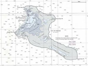
Click on image to expand Click on image for map of the island
It lies 232 km (144 mi) north of the the Equator, 6,700 km (4,200 mi) from Sydney and 5,360 km (3,330 mi) from San Francisco. Christmas Island is in the world's farthest forward time zone, UTC + 14, and Christmas Island is the first inhabited place on Earth to experience the New Year each year.
The entire island is a wildlife sanctuary and access to five particularly sensitive areas is restricted. The island is perhaps best known for the nuclear tests conducted in the region around Christmas Island by the United Kingdom in the late 1950s, and by the United States in 1962. During these tests islanders were not evacuated.
The name "Kiritimati" is a rather straightforward translation of the English word "Christmas" into Gilbertese — where the 'ti' combination is pronounced 's'—as in the English word nation. Similarly Kiribati is a transliteration of Gilberts with the K replacing the G and the R replacing the L.
Population: Approx 5000
Area: About 322 kilometers (124 sq miles)
Latitude: 1° 52' North
Longitude: 157° 20' West
Time Zone: UTC +14
Useful web sites:
Wikipedia
Weather forecast in Kiritimati
1957 Amateur Radio operation from Christmas Island
|
|
|
|
|